|
|
"A comprehensive, collaborative elections resource."
|
WA State House District 9 Seat 2 - History
 | State House DETAILS |
|
|
| Parents |
> United States > Washington > State House > WA State House District 9 Seat 2
|
|
Raw Vote Total:
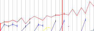
Percentages:

|
| Website | |
| Established | September 01, 1966 |
| Disbanded | Still Active |
| Last Modified | Ralphie January 06, 2011 09:38pm |
| Description | Historical boundaries
1967-1972: Whitman, Lincoln & Adams counties
1972-1981: Adams, Asotin, Garfield, Columbia, Grant & Whitman counties
1981-1992: Adams, Asotin, Columbia, Garfield, Franklin & Whitman counties
1992-2002: Adams, Whitman, Asotin & Spokane counties
2002-Present: Adams, Asotin, Garfield, Whitman, Franklin & Spokane counties
Current boundary
Represents rural southeast Washington: Adams, Asotin, Garfield and Whitman counties, and parts of Franklin and Spokane counties. Includes the cities of Colfax, Cheney, Pullman, Clarkston, and Ritzville.
Historical Maps
1965-1972: [Link]
1972-1982: [Link]
1982-1992: Not Available
1992-2002: [Link]
2002-Present: [Link]
Previous District
[Link] |
|
Redistricting: Light Green=Added Territory, Red=Removed Territory, Dark Green=Kept Territory
| |
|
| |
|
| |
|
| |
|
| |
| No Map In System
| |
|
[Download as CSV]
|